It delivers what it promises…
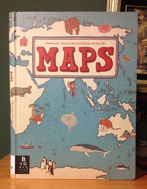
I love coffee table books. They’re just these huge, panoramic sources of information and, as a kid, I particularly loved them because, in addition to being beautiful, they also seemed like something that belonged to the world of parents. There’s something about a kid reading an over-sized coffee table book that just feels subversive, like the kid is somehow reaching above their station and accessing forbidden knowledge. That is one of many reasons why I found impossible to resist buying my daughter a copy of Maps by Aleksandra Mizielińska and Daniel Mizieliński, a gorgeous world atlas by Big Picture Press that’s so beautiful, you’ll want to frame every two-page spread and hang it on your wall.
I encountered Maps for the first time last week during an impromptu trip to New York City. I had some time to kill, so I found myself browsing the New York Public Library (OK, I’ll admit, I was doing a self-guided Ghostbusters walking tour) and I saw Maps in the gift shop. After two minutes of flipping through it, I was hooked and it became my daughter’s souvenir from my trip.
Maps isn’t an exhaustive world atlas. It features 52 maps – including hand-drawn maps of all seven continents and individual maps of several major countries in each. (North America, Antarctica, and Australia are easily served, while the rest of the continents only get featured selections.) While that might rankle any completists out there, I should say that Maps isn’t trying to be an exhaustive cartography resource. There are other atlases for that (or even apps). What Maps is trying to accomplish is a little more interesting and a little harder to do. It’s trying to give kids a taste of what the rest of the world is like. It’s trying, through art, to convey a sense of what these countries are all about. Which is ambitious to say the least, but I think it largely accomplishes its goals.

Click to expand this to something closer to its in-person glory…
Each country gets a two-page spread and, in addition to the country’s rivers and borders, Mizielińska and Mizieliński populate each map with an exhaustive series of icons and details that call out some of the distinguishing features of the country in question. The marginal illustrations show you what the people look like, they recount the country’s history, they show you the food, the flora, the fauna – each map really does try to show young readers how each country FEELS, which is a lot more impressive to me than any topography or latitude-and-longitude map.
You might be saying, “But I have a National Geographic app that my kids love that will answer any geography question they have.” And that’s great. BUT those apps… they’re amazing for reference, but a book like Maps is built for rumination. This book is made for a child to spend a rainy day, pouring over the pages, exploring every inch of each page with their finger, and slowly, slowly actually learning something about Greece through osmosis. That’s just not possible with an app. Too often with apps, the functionality dominates. Yes, there’s a pop-up that explains about the history of Greece, but your kid is spending more brain energy enjoying the “whoosh,” “pop,” and “wow” elements of the pop-up than the actual content it contains. So, while it might be a great resource for a research paper, at its heart, that app is still a game. It’s a button they can press more than anything else.

Click to expand…
Every kid needs a few big, broad books that they can lose themselves inside. Maps is definitely one of those books and it offers them a much more intimate and engaging look out into the whole wide world than most picture atlases ever could. There are endless books at the library if your kid needs to know every single detail about every single country in the world. But, if you want to introduce your child to the world in a more natural way, this book is a great start.
THE DETAILS ON MAPS:
AGE RANGE: Any kid could flip through this book and enjoy it. There’s nothing inappropriate, but maybe wait until they’re 3 or 4 to make sure they don’t rip the pages. (The stated age range is 7 to 10.)
PAGE COUNT: 112 pages
RELATED WEB SITES: You can find the Big Picture Press webpage for Maps here.
BUY IT, BORROW IT, OR FORGET IT?: Because this is a big, beautiful art book, it is, predictably, not cheap (retails for $35). If your library has a copy, maybe check it out first before you buy to make sure it clicks with your kid.
IF YOU LIKED MAPS, YOU MIGHT ALSO LIKE:
The Lonely Planet Not For Parents Travel Book – I’ve written about this one before, amid a larger discussion of travel writing for kids, but I think it’s a cool guide to world cultures that my daughter really enjoys.
People by Blexbolex – This very cool illustrated guide to the various kinds of people in the world by Blexbolex has the same artistic virtuosity and long-term browse appeal that Maps has.
{ 3 comments… read them below or add one }
Gorgeous! Just added this to my list of things to get my 1 yr old nephew when he’s a bit older. Even now he loves studying all the details in his board books.
Some of the comments on Amazon refer to several countries being omitted (Ireland, Argentina, Israel, to name a few). Can you confirm if some of these are indeed not included in the book? If so, what’s your impression of the author’s omissions?
I think I touched on this in my review, but, yeah, not every country is in the book. Asia, Europe, Africa, and South America definitely got the “featured countries” treatment.
And I get why that would bother some people, particularly if one of the omitted countries is where you’re from, where your family is from, if it’s your favorite country, etc.
But the thing about this book is that it’s almost more of a travelogue than a traditional atlas. I’d never use this book to chart a trip across the world, but the maps for each selected country do a remarkable job of introducing you to each country and giving you a sense of what they’re all about. This is almost like an artist’s sketchbook recounting a trip around the world that involved all seven continents.
I can’t really say that I understand why certain countries made the cut and others didn’t – could just come down to the author’s personal preference – but, yeah, be forewarned, this is a very subjective book. It shouldn’t be your child’s only exposure to geography. But I have to say – the subjectivity and insights in MAPS are perhaps my favorite features of the book.
You must log in to post a comment.